Image
Certain areas of the region could experience up to eighteen inches of snowfall due to a multi-hazard Nor'easter.
The National Weather Service has determined the storm will take place beginning Monday night, March 13, and last until late Tuesday evening, March 14.
Throughout the region, the impact will be felt by all, with the probability of considerable snowfall posing the most prominent hazard for inland areas, and flooding and gale-force winds promising to result in numerous power outages alongside the coast.
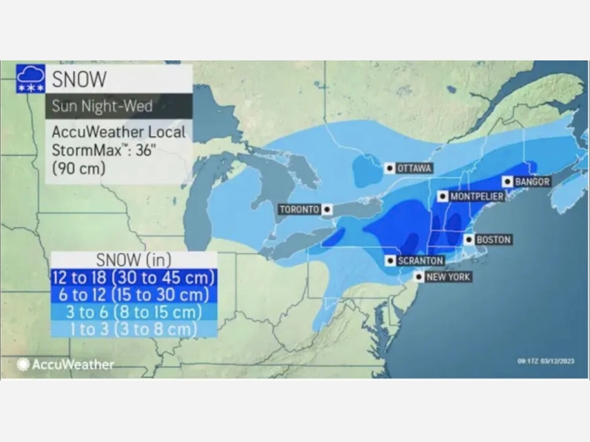
To find out predicted snowfall amounts for the entire region of the Northeast, take a look at the first photo from AccuWeather.com.
The I-84 corridor should expect to have around 8 inches or more of snowfall, and parts of the area may even experience up to 18 inches, as seen in the second image from the National Weather Service.
The Nor'easter is forecasted to bring precipitation initially in the form of rain and rain mixed with snow before transitioning to all snow across much of the Northeast region on Monday night into Tuesday.
Snow is forecasted to persist in the area north of Interstate 84 through Tuesday evening, leading to greater totals of accumulation.
The west should experience a dwindling of precipitation late Tuesday night and gradually move eastward.
Beginning Monday evening on March 13, winds may blow at speeds between 40 and 70 mph.
The third image above displays places most likely to suffer blackouts resulting from trees, power lines, and gusty winds.
Wednesday, March 15 is forecasted to be mostly cloudy, with a gusty breeze, and the high temperature is estimated to be approximately 40°.
The exact path, when it will hit, and intensity of the storm remain unclear.

Partly Cloudy, with a high of 71 and low of 56 degrees. Sunny in the morning, overcast during the afternoon and evening, mist overnight.