Image
Long Island
The National Weather Service has issued a Wind Advisory for Long Island, as the Nor'easter storm triggers a snowfall.
Starting from 8 p.m. on Tuesday and extending through 11 a.m. Wednesday, wind from the Northwest with speeds between 20 and 30 mph and gusts reaching as high as 50 mph are forecasted.
Snow should last until 2 o'clock and rain will most likely occur until 5 o'clock.
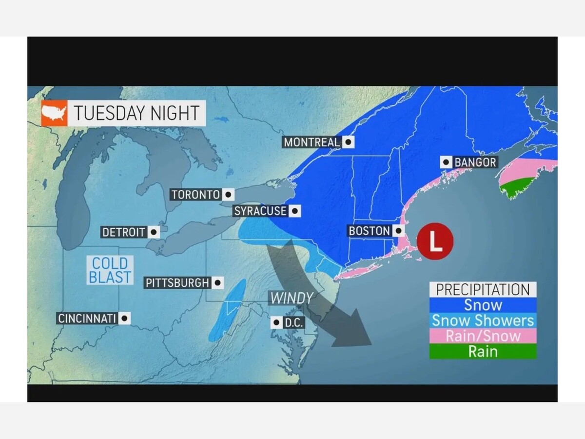
This is the forecast for the upcoming two days:
On Tuesday, snow and rain are expected before 2 PM, followed by rain between 2 PM and 5 PM, with rain and snow again after 5 PM. The temperature is forecasted to reach a high of 38, and the wind chill values are projected to be between 25 and 30. Winds will be strong out of the west, blowing between 24 and 29 mph, with higher gusts possible. Precipitation is almost certain, with the possibility of up to half an inch of snow accumulation during the day.
On Tuesday night: Snow is likely before 8 PM, with a chance of snow showers between 8 PM and 2 AM. The temperature will be around 33°F and the wind chill will be between 20°F and 25°F. There will be a brisk northwest wind blowing at speeds of 21 to 24 mph, with gusts as strong as 40 mph. The likelihood of measurable precipitation is 80%. A dusting of snow of less than 0.5 inch is possible.
Wednesday: Cloudy at first, followed by an increasing amount of sunshine, with a high temperature of 44°. Wind chill temperatures will range from 20 to 30°. Windy conditions, with a gusty northwest wind around 26 mph, with gusts of up to 41 mph.
Wednesday evening is forecast to be mostly clear, with temperatures dropping to an estimated low of 29°F. Northwest winds are expected to blow between 15 to 22 mph, with gusts up to 33 mph potentially making the air feel as low as 20°F - 25°F.

Sunny, with a high of 86 and low of 65 degrees. Mist for the morning, sunny in the afternoon, clear in the evening, partly cloudy overnight.